Location....The village of Rathgormack is located in the northern part of Co.Waterford...

Rathgormack is 3 kms off the R676 road from Carrick-On-Suir to Lemybrien / Dungarvan.

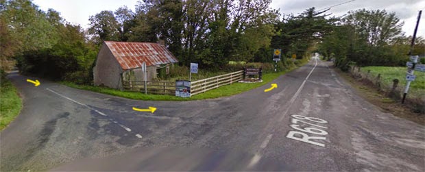
The crossroads which is at the junction of the R678 and R676 roads is 10kms from Carrick-On-Suir. The junction as seen from the Carrick side is shown below. Turn right for Rathgormack...

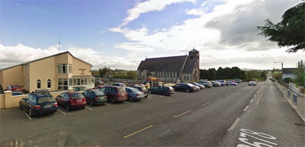
The race HQ is at the Rathgormack Hiking Centre which is next to the church in the village...
Course map...The course consists of two loops....one small and one large. You start just up the road from the hiking centre and take in one loop near the village. After completing that lap, you then proceed to do the second larger loop in the countryside to the south-east before returning to finish at the hiking centre.

This is the small loop in more detail....pink arrows for the initial loop...yellow arrows afterwards...

Course profile....

Course description...The race starts about 200m from the hiking centre...

As you can see, it's dead straight and slightly downhill making it very fast for the first few hundred metres.
At about 500m, you turn left. As you can see, it's downhill to the junction and then it levels off...

There is a drop of about 20m in elevation from the start to the junction above so that needs to be gained again. The road passes the graveyard at the rear of the church and remains pretty level as far as the next junction...

From there (~0.6 miles), you turn left and begin the gradual climb...

Left again at 0.7 miles and the gradual climb continues....

At about 0.9 miles, you take a left at the crossroads and the end of this particular climb. From here, it's back past the start line and back downhill through the village again...
At about 1.3 miles, you get to the bottom of the hill again except this time you carry straight on...

The next 200m or so are flat and at 1.4 miles, you come to the start of the large loop where you carry straight on up a slight pull...

The gain in elevation here is 10 metres at most and at 1.6 miles, you begin a rapid descent. Over the next 600m, you lose 35m in elevation until you reach the bridge over Aughatanwillin Stream at about 2 miles...

From here, it's a gradual climb again as you gain a modest 15m or so in elevation over the next 800m.
At the halfway point at 2.5 miles, you reach the top of this climb when you turn right at Feddan's Cross...

You now start another fast downhill section which is about 600m long with views of the Comeragh Mountains in the distance...

At 2.8 miles, it bottoms out as you cross over the small stream again. On the other side, there is a gentle climb which soon levels off before falling slightly.
At 3.4 miles, you take a right and head for home...

From here, you have a climb in elevation of about 55m over the next 1.6 miles.
View at 3.8 miles...quiet road and a gradual climb...

Junction at 4.1 miles where the road sweeps around to the right....


At 4.7 miles, you finish the large loop when you rejoin the road you were on earlier...

From here, it's flat for about 200m and then uphill all the way to the finish line outside the hiking centre...

Overall......An undulating course with plenty of hills. Possibly not one for setting personal best times. Nice scenic course set against the background of the Comeragh Mountains.


