Showing posts with label 10 km. Show all posts

Misc002

Directions to the Piltown 10 km road race...

Piltown is located in the south-west of County Kilkenny, just a few kms to the east of Carrick-on-Suir...


The headquarters for the race is at the local GAA grounds in Piltown. This is only 1 km from the N24 Carrick-On-Suir to Waterford road...

From the N24, take the western entrance to the town...

Left at the tower...

....and down a long straight and then left at the next T-junction....

Piltown GAA grounds are just on the left after about 200m...

Course map...


Course description...The race starts just inside the entrance gates of Kildalton College...

After about 2 kms of running on quiet roads within the college grounds, the course joins the public roads at about the 1.4 mile mark...

Then it's across a bridge and up a small hill past the two churches...

At 1.8 miles, the race course takes the left fork onto a quieter straight road...

Initially the road is slightly downhill but climbs up at the end until you reach the highest part of the course at around 2.3 miles and you turn left...

From here, the road drops downhill to the lowest point of the course at 2.8 miles and climbs gently up the other side...

At 3.3 miles, you turn right at the crossroads...

...and then a slight downhill again...

At 3.7 miles, you reach a T-junction and you turn left...

From here, the next 1.3 miles are dead straight on a road that is going very slightly uphill...

Towards the end, the road begins to twist again and has a bit of climbing again. At 5.4 miles, you hit another high point as you turn left at the T-junction...

From here, it is mostly downhill to the GAA grounds where you turn in right and on towards the finish line...

Overall........A 10 km course that starts in Kildalton Horticultural College and then proceeds to run around most of it's perimeter. Several hills spread throughout the course but most are fairly minor. Lots of quiet country roads. Reasonably fast course.

Tipperary015

Preview of the Dundrum AC Coillte 10k road race.....

Location.....The picturesque village of Dundrum is located in South Tipperary, about 8 miles from Tipperary Town and 9 miles from Cashel. The map below shows the approach roads and it is well signposted.

The race HQ is at the Dundrum Community hall. The start line and finish line are within 200m of the scout hall....

Entrance to the Community Hall from the road....

A useful landmark is the local Centra store. Below is the view from the south-west showing the entrance to the community hall and the start line is beyond that...

Plenty of space for parking at the hall...


Course map........The map of the course is shown below. It's basically two laps of a 5k course...

Course Profile.......Very flat...


Course description....This is the view from the start line...dead straight and flat as you run past the Centra Store...

Just after the store, you pass a garage and the finish line is just beyond that...roughly 200m or so after the start line...

At the junction at 400m, you stay on the road straight ahead...

As you leave the village behind, the road ahead is dead straight and flat....

Around 0.9 miles, you pass the entrance to Marl Bog Forest on the right, famously known locally as  the Duck Pond. This picturesque location is used by members of Dundrum AC for much of their training and is a nice area to visit.


Just after the 1 mile mark, it's left at the next crossroads......

.......and onto a smaller road but it continues mostly straight....and again, pretty flat...

At 1.7 miles, you turn left...

.........onto an even narrower country road....Again...straight and flat...

At 2.4 miles, you come to a crossroads where you turn right.....

....and onto the Green Road....another straight and flat road...

The Green Road comes to an end around 2.7 miles when you come to the road junction with the R505...the main road from Cashel. Turn left here...

....and continue into the village...again, straight and flat...

...passing St.Mary's Church...one of several impressive sandstone buildings in the village.

Around 2.9 miles, you enter the village proper...

...and at around the 3 mile mark, you take a left at the crossroads.......

....and up the road to the 'Start' line to complete the first lap.

One more lap and it's past this point for a second time to run on to the finish line.

Overall.......Picturesque village with a lot of history. Seriously fast 10k course. Hardly a hill worth talking about and plenty of long straight sections. Must be one of the fastest 10k courses in Munster if not the country.

Additional info for spectators.....Note the points A, B and C below. If you move between these points which are just over 100m apart you can see the athletes at approx. 0.25miles , 2.4miles, 3.2miles and again at 5.4miles.

Tipperary004


Preview of the Annerville 10 km road race...

This 10 km road race is organised on an annual basis by Clonmel Athletic Club. Located in South Tipperary, it's within easy access of a lot of runners from the surrounding counties. It is 11 miles / 17 kms from the M8 Cork to Dublin motorway.


The two part map below shows where everything is...


Directions...Coming from Cork / Limierck / M8 motorway..If you are coming from the west, you follow the signs for Waterford (N24) and take the relief road that goes around to the north of the town. Go through the Cashel roundabout and keep going east. As you approach the next roundabout, you'll see a sign showing Fethard to the left and Town Centre to the right....


Follow the signs for the town centre and take the 3rd exit on the Fethard Road Roundabout...

The road narrows as you cross a bridge over the railway line and then almost immediately, you take a left onto Thomas St...

Just keep following this road and soon, it changes to Dillon St. Eventually, you come to a road junction straight across from Clonmel Vocational School (behind the trees!) which is the race HQ...

Parking is available 300m away. Left at the junction and then straight away, a right...


The Suirside car park is about one hundred metres up this road on the left...

Directions coming from Waterford / Kilkenny.....If you are approaching from the east on the N24, stay left at the first roundabout and follow the signs for Town Centre and Clonmel.


You then drive through the next roundabout, past the Lidl store, past Dunnes Stores, through the roundabout at the Showgrounds Shopping Centre.........i.e. keep going straight. As as you begin to enter a more built up area with older style buildings, you turn left at the Clonmel Veterinary Clinic...


As per the earlier photo, parking is available up the road about 100m on the left.

Directions from Dungarvan......If you are approaching Clonmel on the R671 from the south-east, you will come to the Dungarvan Roundabout...

The town is signposted to the left but it's easier to stay south of the town and carry straight on.

Keep going until you come to the next roundabout and take a left there...

You cross over a bridge and about 50 metres further on, you'll see the entrance to the car park on the right.

The race course itself......


The race starts just outside the vocational school...

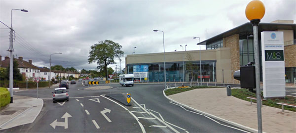
After 300m, you pass the Showgrounds Shopping Centre...

At about 800m, you pass the local Lidl store on Davis Road. As you can see, the course is dead flat and stays like this for at least the next 1.5 miles.

After 0.7 miles, you go through another roundabout...

...and then another one at 1.3 miles...

At the next roundabout at around 1.9 miles, you turn right...

Now the course changes completely as you leave the traffic behind and run on quiet roads. The sign below near the two mile mark shows whats ahead...

....and it's the first 'hill' ;o) .....a humpback bridge over the River Suir....

From the middle of Sir Thomas's Bridge, there is a great view of the surrounding countryside. You can just make out the next bridge ahead...

Devine's bridge is only about 200m beyond the first one. You turn right here and head back in towards the town.

Along this section, you come across the first of two real hills along the course. The road climbs gradually, flattens out and then climbs again...

At about 3.6 miles, the road flattens out and pretty soon, the gradual descent begins...

At about 4.3 miles, the road begin to level out as you reach the roundabout near the Loreto Convent...

The road then continues a gradual descent as you reach two sharp bends around the 4.7 mile mark at Edel Quinn Park....

......with Bernie Macs Pub on the second bend, a usual spot for a water station.

 After this, the second real climb begins at 4.8 miles.......

.......and lasts until the Dungarvan Roundabout at 5.3 miles where you turn right...

As you head back in towards the town, the road drops gently before rising again as you cross over  Workshop Bridge at 5.5 miles...

At 5.7 miles, you turn right at the next junction and you can see the long finishing straight ahead. In the distance, you can see the spire of St.Mary's Church which is just beyond the 6 mile mark.

Nearly there......St.Mary's Church just after the 6 mile mark with the finish line in sight...

........and finally, the finish at the iconic West Gate...

From the finish line, it's only a few hundred metres back to Race HQ.

Overall......A reasonable course with two hilly sections. Plenty of flat and fast sections as well....especially the run in towards the finish line. A race with a bit of everything....town and country......flat and hilly. Expect a reasonable time.

Race HQ