Entries for the race are usually taken at St. Joseph's primary school, Dungarvan. This is right alongside the church as you drive into the town from the Cork side. There is plenty of parking nearby near the start and near the local sports centre.
Map of the course...
Course description...The race starts at the waters edge near the band stand...
.......and about 200 metres later, you come to the first hill! ;o)
...but it's only a small one. Coming so early in the race, you'd hardly notice it. The road climbs gently here for a few hundred metres as you run past the school where you entered earlier.
The road soon levels out and veers left as you head south-west. At around the half mile mark, the road begins to drop gradually...
This is a very fast section which begins to level out just before the one mile mark. It should be a fast opening mile despite the small hill. Just after the mile mark, you take stay left at the roundabout...
From here, the road is initially narrow but soon widens out so that you'll find yourself running inside the hard shoulder. From the roundabout to about 1.6 miles, it is more or less dead flat........
.....and then it drops gradually all the ways down to the 2 mile mark...another very fast mile.
From the 2 mile mark, the road continues to fall until it flattens out and crosses over the River Brickey at about 2.4 miles. At 2.6 miles, you turn off left onto a quieter road...
........and about 100m later, you turn right onto a even smaller road....
This is an important point in the race as it marks the end of the easy running! The warm up is over, the real work lies ahead. If you notice on the left of the picture above, you'll see that the road begins to climb. Note that this is the start of a 2.7 mile gradual climb all the way up to the 5.4 mile mark. In other words, as far as you've run up to now except that it's all uphill. The trick is of course to run at a nice steady pace over the 2.7 miles rather than tearing into it. Anyone who picks the second option is likely to fade well before the top.
The hill once it starts will feel unrelenting. Through the hairpin bend at 3.2 miles...
...onwards and upwards to the next sharp bend at 4.1 miles...
Along this next stretch of road, you really begin to appreciate how high you are now above the valley floor...
The view above is just after the bend, around 4.2 miles. The mountains to the left are the Knockmealdowns on the Tipperary/Waterford border and the Comeragh Mtns are on the right and to the north.
And so the road continues...onwards and upwards. Just around the next corner at 4.3 miles, the view opens up to the east over Dungarvan Harbour...
Now, the road slowly swings around to the right and you join the main road at about 4.6 miles...
Note that this is the N25 which is the main Cork-Waterford road. Be careful of any traffic and stay in well to the left. As the road climbs, you pass a small lay-by around the 5 mile mark...
There is only a mile left to go now. After the lay-by, the hard shoulder narrows to a sliver again so stay well in to the left again. At 5.4 miles, you take the left fork and leave the main road as you finish the long climb...
From here to the finish, the course becomes a lot faster again. Straight through the crossroads at 5.6 miles...
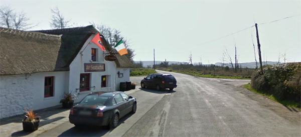
......and on to a long sweep to the right. There is even a slight fall in ground here so it's a very fast run into the finish line near the back of the Marine Bar...
Overall......A tough challenging course that is split up into two halves. Easy for 2.7 miles, tough for another 2.7 and a short fast section at the end. Maybe not one for those who just like flat fast 5k courses but it really is an excellent course for those who like something a bit tougher.
The Marine Bar has been located on this spot for well over 200 years. Named after the soldiers that used to stop here, it was a long history which can be seen HERE
Organised by West Waterford AC


